2026
- ICLR
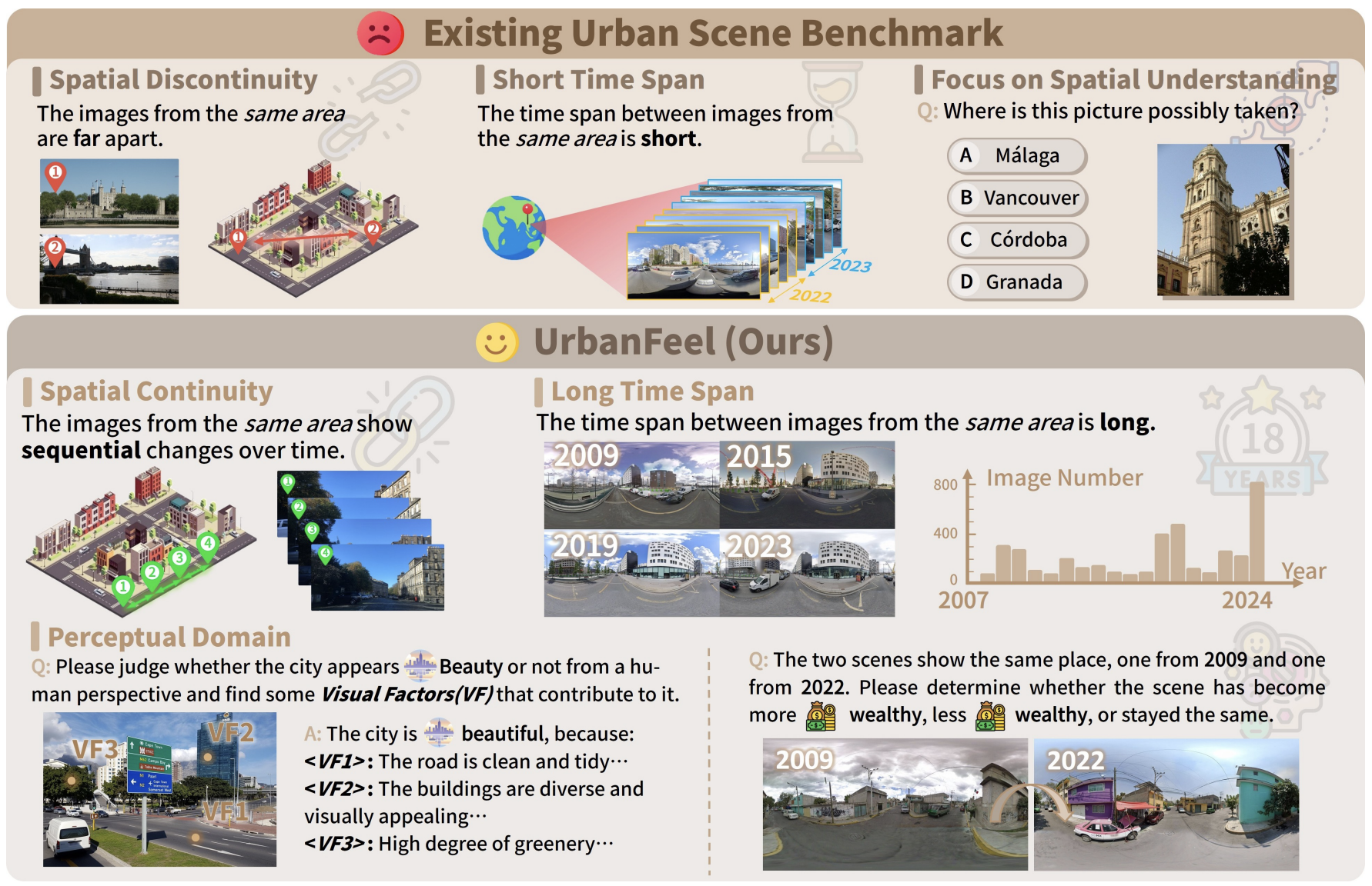 Urbanfeel: A comprehensive benchmark for temporal and perceptual understanding of city scenes through human perspectiveICLR 2026
 - ICLR
- CVPR
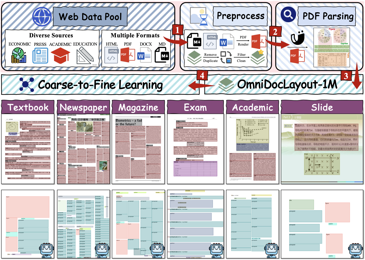 OmniDocLayout: Towards Diverse Document Layout Generation via Coarse-to-Fine LLM LearningCVPR 2026
 - Arxiv
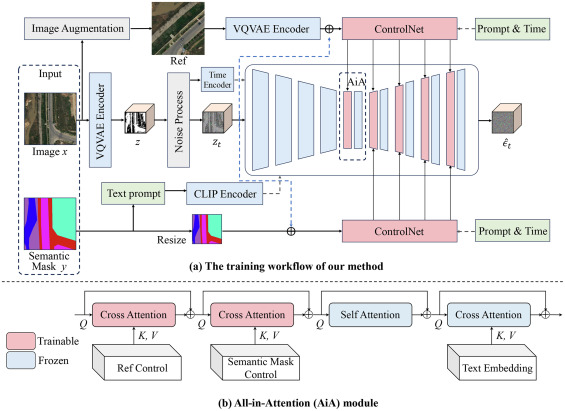
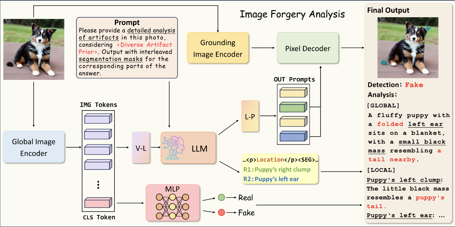
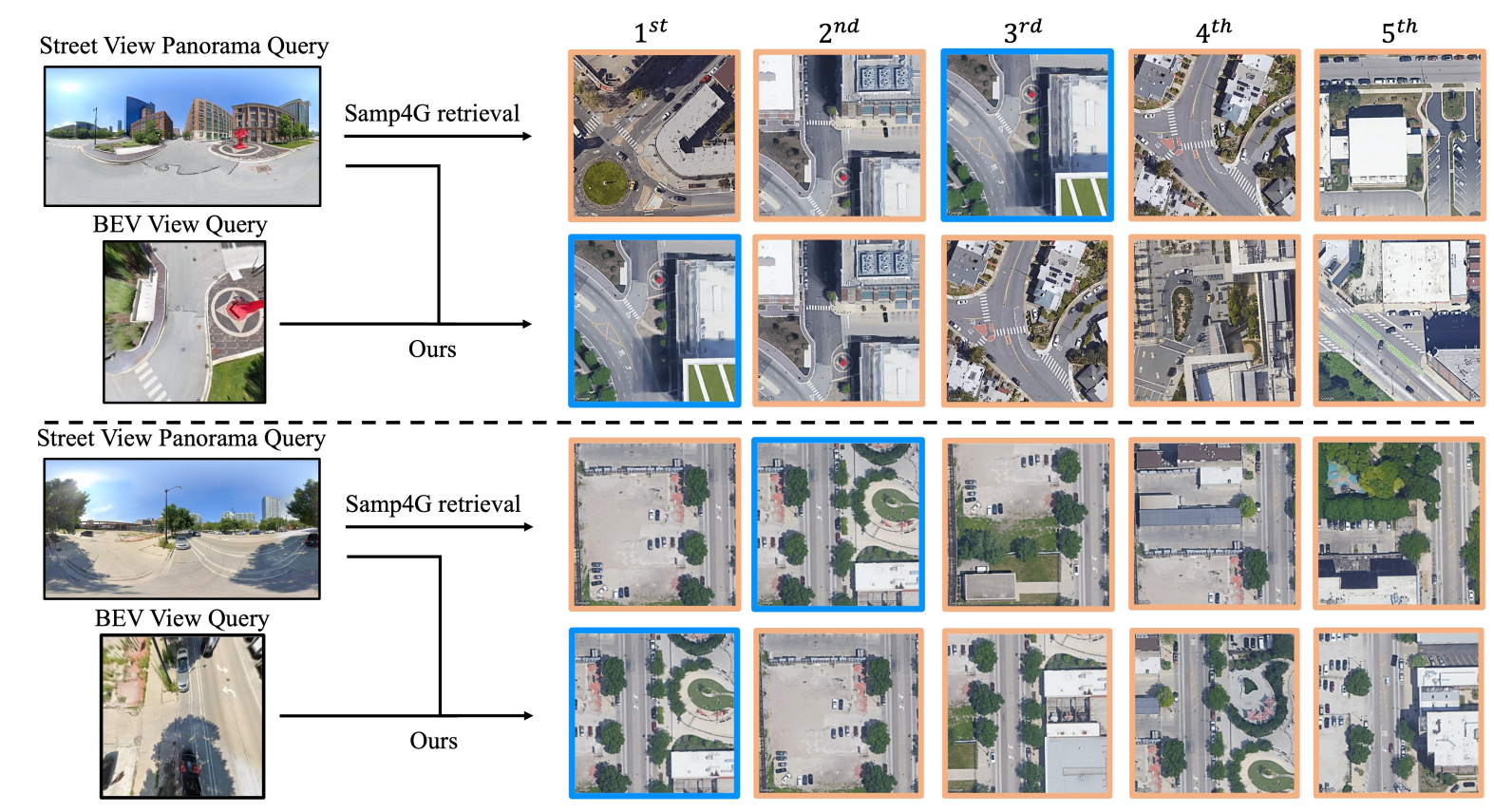
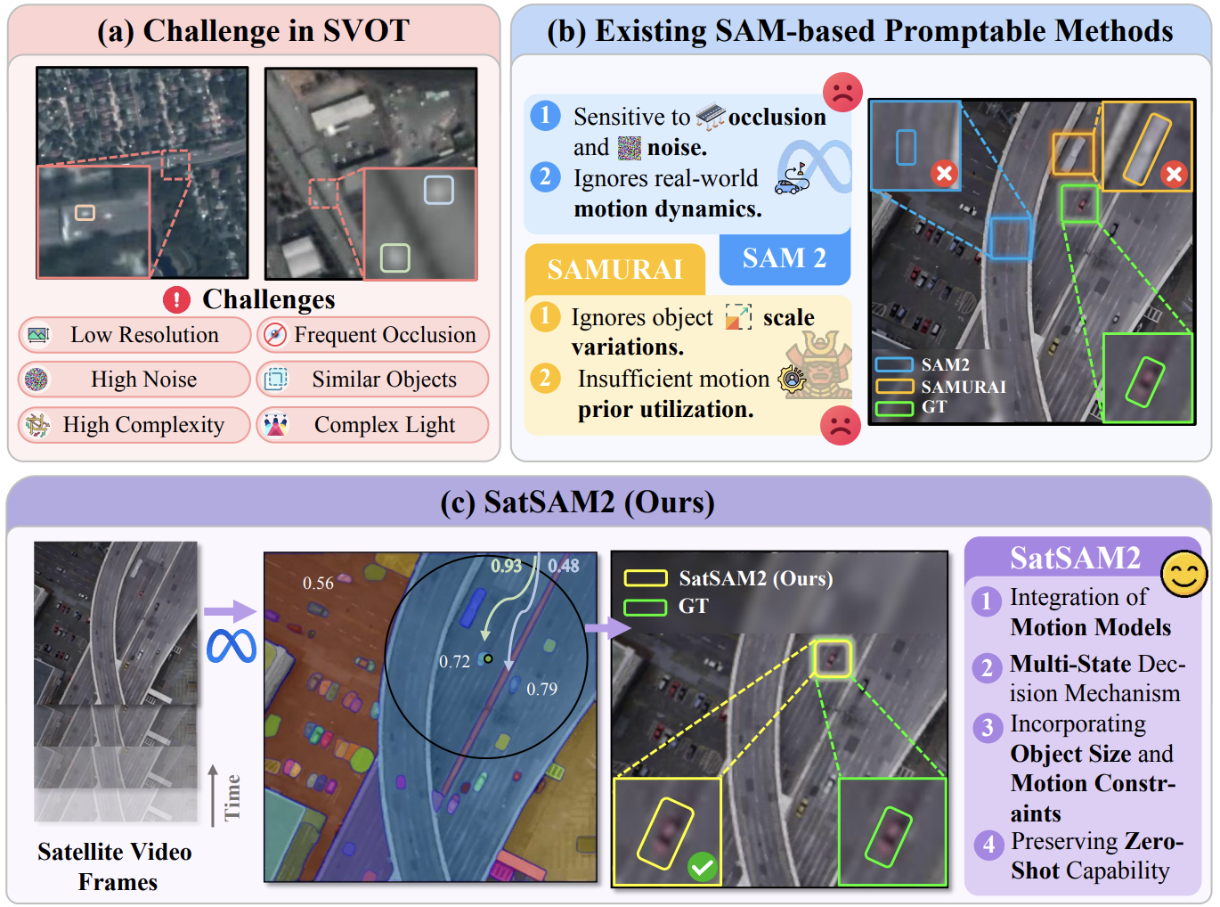 SatSAM2: Motion-Constrained Video Object Tracking in Satellite Imagery using Promptable SAM2 and Kalman PriorsarXiv 2026
2025
- GRSM
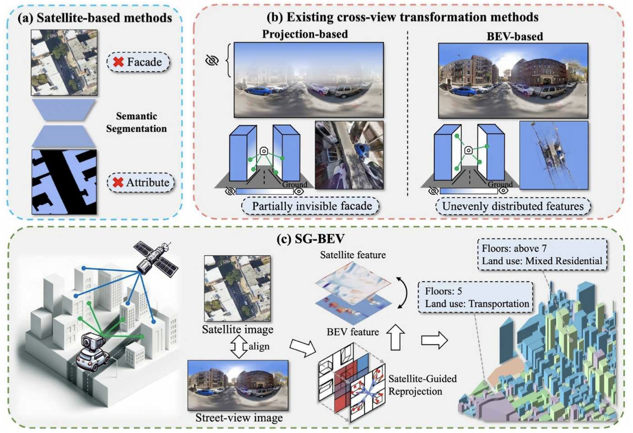
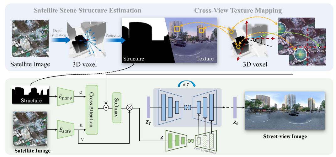
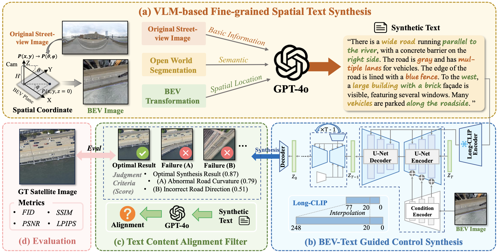 Satellite image synthesis from street view with fine-grained spatial textual guidance: A novel frameworkIEEE Geoscience and Remote Sensing Magazine 2025
 - INFFUS
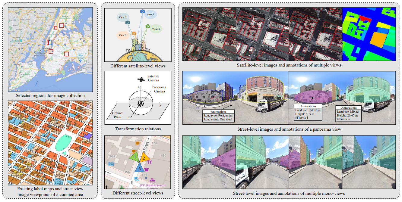
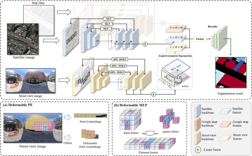 CRFFNet: A cross-view reprojection based feature fusion network for fine-grained building segmentation using satellite-view and street-view dataInformation Fusion 2025
 - INFFUS
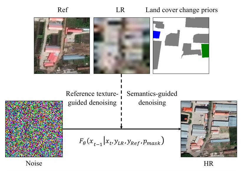
 Transferable Image Synthesis for Remote Sensing Semantic Segmentation Via Joint Reference-Semantic FusionInformation Fusion 2025
 - JAG
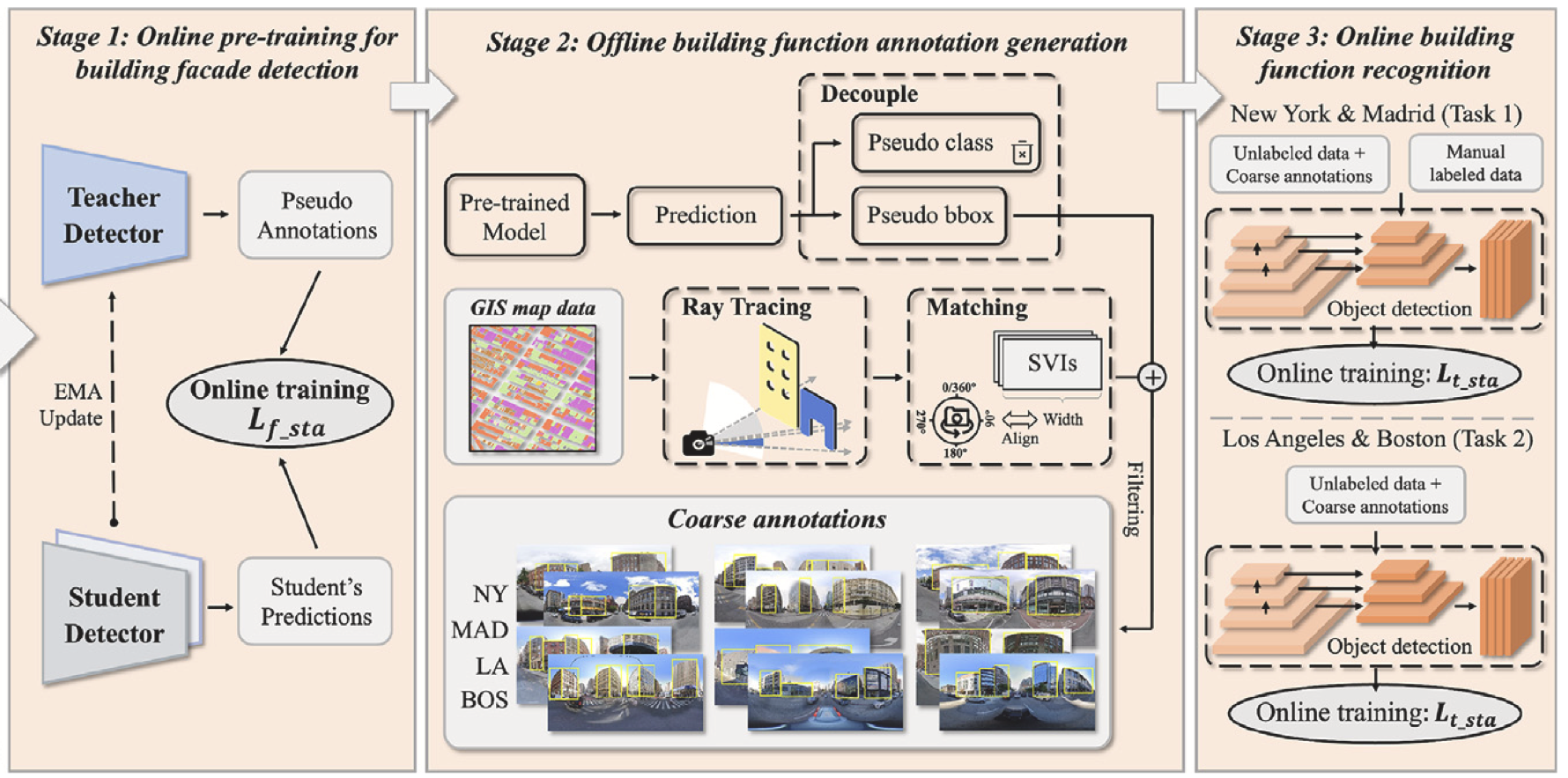 Fine-grained building function recognition with street-view images and GIS map data via geometry-aware semi-supervised learningInternational Journal of Applied Earth Observation and Geoinformation 2025
2024
- TGRS
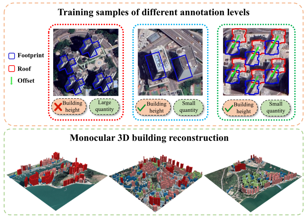
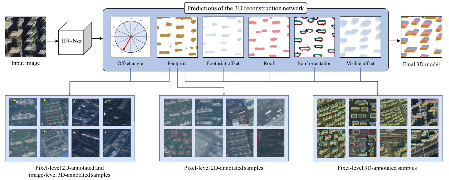 Weakly Supervised 3-D Building Reconstruction From Monocular Remote Sensing ImagesIEEE Transactions on Geoscience and Remote Sensing 2024
 - GRSM
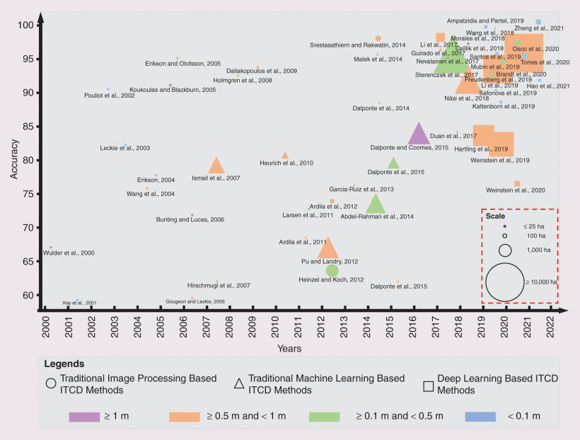 A Review of Individual Tree Crown Detection and Delineation From Optical Remote Sensing Images: Current progress and futureIEEE Geoscience and Remote Sensing Magazine 2024
 - ISPRS
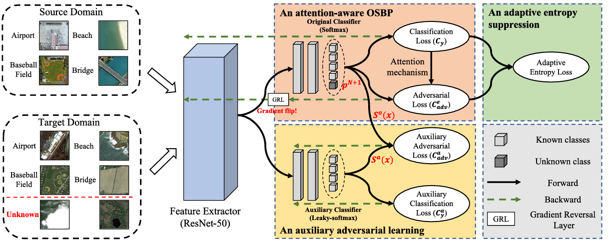 Open-set domain adaptation for scene classification using multi-adversarial learningISPRS Journal of Photogrammetry and Remote Sensing 2024
2023
- AAAI
- RSE
 Surveying coconut trees using high-resolution satellite imagery in remote atolls of the Pacific OceanRemote Sensing of Environment 2023
 - ICCV
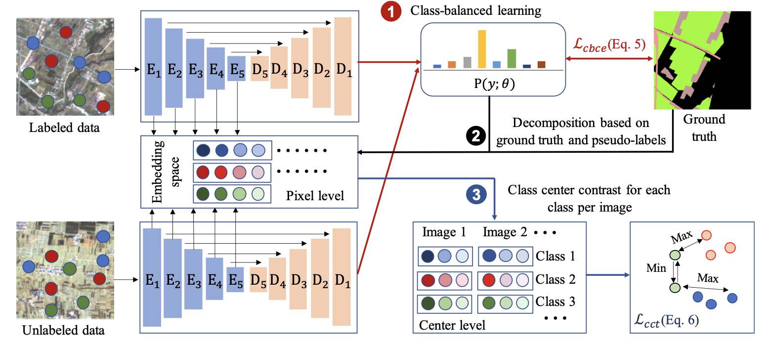 Large-Scale Land Cover Mapping with Fine-Grained Classes via Class-Aware Semi-Supervised Semantic SegmentationICCV 2023
 - JAG
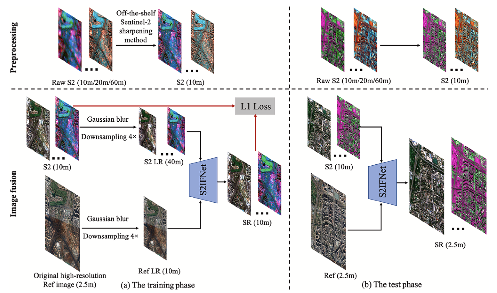 An adaptive image fusion method for Sentinel-2 images and high-resolution images with long-time intervalsInternational Journal of Applied Earth Observation and Geoinformation 2023
 - TMM
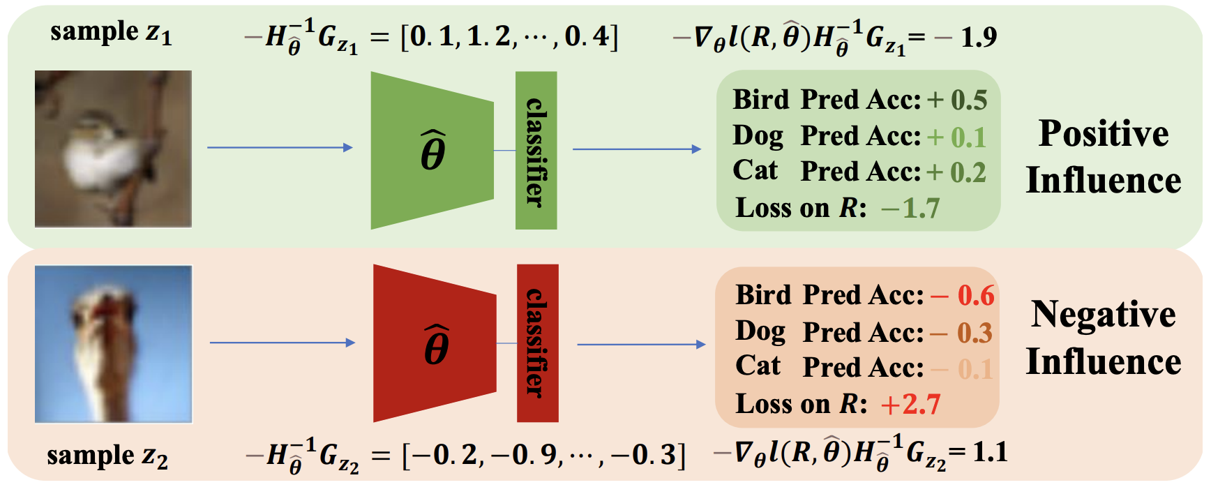
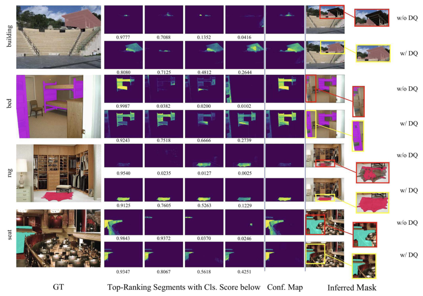 DropQueries: A Simple Way to Discover Comprehensive Segment RepresentationsIEEE Transactions on Multimedia 2023
2022
- TGRS
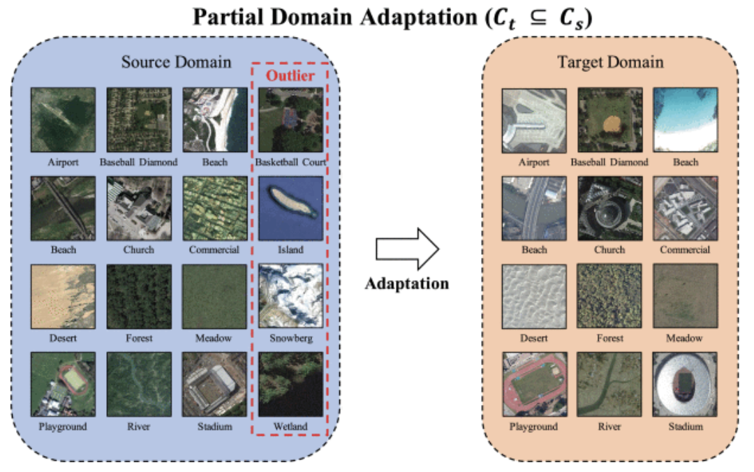 Partial Domain Adaptation for Scene Classification from Remote Sensing ImageryIEEE Transactions on Geoscience and Remote Sensing 2022
2021
- TGRS
 A Two-Stage Adaptation Network (TSAN) for Remote Sensing Scene Classification in Single-Source-Mixed-Multiple-Target Domain Adaptation (S^2M^2T DA) ScenariosIEEE Transactions on Geoscience and Remote Sensing 2021
 - GRSL
Multisource-Domain Generalization-Based Oil Palm Tree Detection Using Very-High-Resolution (VHR) Satellite ImagesIEEE Geoscience and Remote Sensing Letters 2021
- RS
Making Low-Resolution Satellite Images Reborn: A Deep Learning Approach for Super-Resolution Building ExtractionRemote Sensing 2021
2020
- IJRS
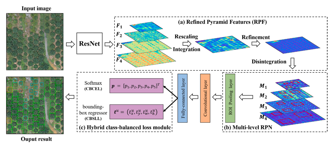
Oil palm plantation mapping from high-resolution remote sensing images using deep learningInternational Journal of Remote Sensing 2020
- RS
Improving 3-m Resolution Land Cover Mapping through Efficient Learning from an Imperfect 10-m Resolution MapRemote Sensing 2020

2019
- RS
A Real-Time Tree Crown Detection Approach for Large-Scale Remote Sensing Images on FPGAsRemote Sensing 2019
- RS
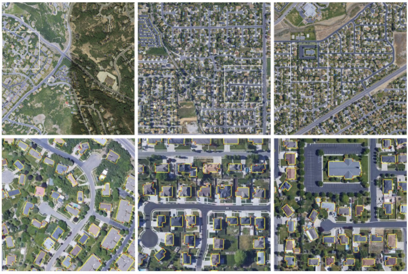
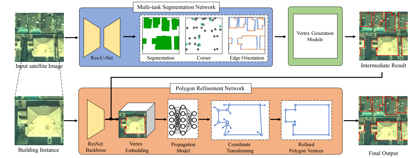
Semantic segmentation-based building footprint extraction using very high-resolution satellite images and multi-source GIS dataRemote Sensing 2019
2018
- CVPRW
Semantic segmentation based building extraction method using multi-source gis map datasets and satellite imageryIn Proceedings of the IEEE Conference on Computer Vision and Pattern Recognition Workshops 2018
- RS
Large-scale oil palm tree detection from high-resolution satellite images using two-stage convolutional neural networksRemote Sensing 2018
2017
- FPT
An FPGA-based tree crown detection approach for remote sensing imagesIn 2017 International Conference on Field Programmable Technology (ICFPT) 2017
- JSTARS
Parallel multiclass support vector machine for remote sensing data classification on multicore and many-core architecturesIEEE Journal of Selected Topics in Applied Earth Observations and Remote Sensing 2017
2016
- RS
Deep learning based oil palm tree detection and counting for high-resolution remote sensing imagesRemote Sensing (ESI highly cited paper) 2016
- IJRS
Stacked Autoencoder-based deep learning for remote-sensing image classification: a case study of African land-cover mappingInternational journal of remote sensing 2016